New category: Etymology
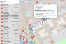
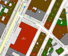
The new etymology category (in the "Culture" section) informs about map features which have been named after someone or something. If a "name:etymology:wikidata" Tag is found, it will link to Wikidata.
There are some new functions for category developers:
map
object called boundaries
which holds the list of boundaries at the map center.map
object called driving_side
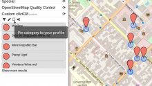
which is either "left" or "right" with regards to the map center.There's a new feature for custom categories and categories of other repositories: You can "pin" or "bookmark" them, so that they get loaded for every visit of OpenStreetBrowser. It is saved in your session, which is long-lived. If you want to backup (or duplicate) your list of pinned categories, you can use the new "YAML" feature of Options.
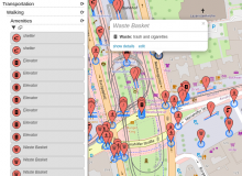
The Walking Amenities category (under Transport -> Walking) now includes more items.
Also, there's a new Walking Amenities category in the "Quality Control" section, which highlights map features with missing details.
Unfortunately I had to remove OSM CycleMap and Transport Map from the list of available basemaps, as the tile limit of the provider Thunderforest was exceeded. I don't want to change to a paid plan, as I do not earn money from OpenStreetBrowser.
This new category shows kerbs (the edge where a road meets a sidewalk). Read more about this in the OpenStreetMap Wiki. The category uses the colours from the Wiki page. Popups will show additional information: type of kerb (lowered, raised, ...), they wheelchair accessibility (if set), if the kerb has tactile paving and the height.
Thanks to a contribution by user danieldegroot2, dates and date ranges are now displayed in Dutch. Other languages which are currently supported are: English, French and German. If you are interested in adding another locale, please check out the module openstreetmap-date-format (HOWTO).
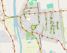
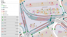
The new "Footways" category (under Transportation -> Walking) shows sidewalks, footways, steps, platforms and pedestrian zones. Sidewalks mapped on the street way (sidewalk:left, sidewalk:right resp. sidewalk:both) will be shown with an offset - hatching indicates the relation.
The christmas season is coming, and with it all those christmas trees and markets! It's the right time to check, if the christmas map in your area is up-to-date. Use the Christmas category on OpenStreetBrowser to check if all features are mapped correctly!
More information in the OSM Wiki.