Writing categories in YAML; new Twig filters (v5.1)

Submitted by plepe on Sat, 07/30/2022 - 20:15

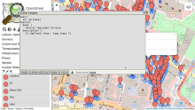
From now on, it's possible to write categories in YAML format. This is much easier than JSON and allows for comments. You can find a few example categories in the documentation on Github. There's a repository with these examples in the OpenStreetBrowser Development environment, which you can fork (you can load this under the big ➕ icon on OpenStreetBrowser).

Communication category now includes parcel lockers

Submitted by plepe on Sun, 01/23/2022 - 14:38

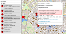
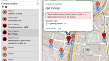
Parcel lockers are a newly approved feature in OpenStreetMap. They are now included in the "Communication" category with a box symbol. I also included the deprecated tags vending=parcel_pickup;parcel_mail_in, vending=parcel_pickup and vending=parcel_mail_in. These will render with a bright red symbol to indicate deprecation, also there's a warning in the popup.

Wikimedia Integration

Submitted by plepe on Thu, 09/24/2020 - 14:39

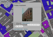
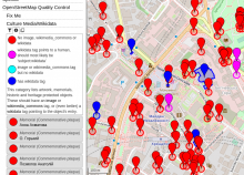
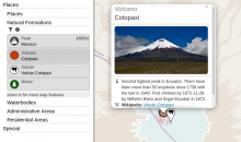
Did you know, that OpenStreetMap and Wikimedia (Commons, Wikipedia, Wikidata, ...) work together? As you might know there are ways to link OpenStreetMap objects to Wikimedia objects (preferably with the wikidata tag, but wikipedia, image and wikimedia_commons are also ways to achieve that). OpenStreetBrowser integrates this and shows images and excerpts of Wikipedia articles in object details.

Recently, I blogged about mapping artwork and memorials with Wikimedia integration on the OpenStreetMap blog. I hope this motivates people, to add more Wikimedia links (and artwork, memorials and pictures thereof)!

Feature update (v4.9): Links in tag listings

Submitted by plepe on Sun, 05/31/2020 - 07:58

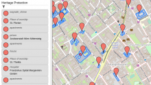
The latest feature update brings links to tag listings of an object. There are a variety of tags which will be converted to links: first of all website, url, phone and similar, but also wikipedia, image and wikidata. Finally the "Tag2Link" rules (JOSM also uses this under that name) are imported from Wikidata and OSM Sophox. In some cases there are multiple possible links, which will be presented in a small popup to let you choose an appropriate provider (as you can see in the screenshot for the 'icao' tag). 

Feature update (v4.8): geo information and editor selection

Submitted by plepe on Sat, 03/21/2020 - 20:10

The toolbar in the sidebar now includes a globe symbol. It will show information about the current view and highlight the view center with a crosshair.

When activating GPS location, your location will be highlighted. Also, details will be included in the toolbar panel.

The details of map features show geographic information about the object: coordinates, length and area (when applicable).

In the Options you can configure coordinate formats and unit systems.

Also, in the Options you can select which editor will be used, when clicking the 'edit' button in a map feature popup.


Feature update (v4.7): Width/Offset of lines in world meters instead of pixels

Submitted by plepe on Sun, 01/26/2020 - 13:04

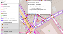
A current update allows symbols to use the scale of the current map view for parameters (e.g. for width or offset of lines). To demonstrate these features, the "Railway gauge" category now shows the rails with the correct offsets (although the exact configuration for multi-gauge rails is neither mapped nor evaluated) (available from zoom level 18). Code. Example.